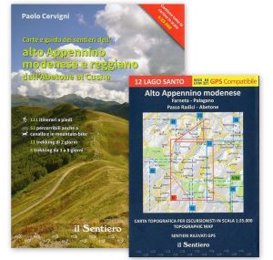


Alto Appennino modenese e reggiano dall'Abetone al Cusna
€29.00

In stock
Product code
ER033
Autore:
Cervigni P.
Collana:
APPENNINO TOSCOEMILIANO
Editore:
IL SENTIERO
Maps and guides of the upper Apennines of Modena and Reggio Emilia from Abetone to Cusna.

Spesa minima per la spedizione gratuita: €50.00
NOTA: Valido solo per spedizioni in Italia

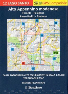
111 walking itineraries, for 460 hours of walking. 53 which can also be traveled on horseback and by mountain bike. 11 2-day treks, for 115 hours of walking. 8 treks from 3 to 8 days, for 189 hours of walking. Beyond the - important - numbers, the guide describes a dense web of paths on the Emilian side of the high Apennine ridge, from Abetone to Monte Cusna, which reaches, towards the valley, the line that connects Quara, Farneta, La Verna, Boccassuolo , Monte Cantiere, Monte Cenere and Ponte Olina, the latter on the Scoltenna stream. East of the Scoltenna, volume 2 of the same series, already published, includes all the paths of the remaining territory of the Modena high mountains. The guide also contains maps at 1:25,000 scale, which show all the itineraries described, with the route taken by the author, with GPS, during 2013; in this way the hiker does not need anything else to be able to easily complete the route. Of the 111 itineraries described, 71 are circular and 40 are on line routes; 73 take place on paths marked by the CAI and the remaining marked by local organizations or enthusiasts, or even without trail signs. However, for each itinerary, all the data is indicated to allow each hiker to choose the most suitable route, such as difficulty, length in kilometres, differences in altitude and walking hours. The author does not limit himself to the precise, detailed description of the path, but enlightens the reader on everything around: panoramas, naturalistic, historical, architectural emergencies, curiosities. All the accommodation facilities in the area covered are also indicated, with all the data necessary to book for lunch or the night. All hikers, from the less experienced to the more experienced, will certainly find the most suitable itinerary. The network of paths described also allows the more experienced to create their own itinerary using the descriptions and maps provided as a basis. Among the many treks that can be done using the guide, 19 are proposed, 11 of which are for weekends. An indispensable guide to get to know the Apennines on foot.
| Product code | ER033 |
|---|---|
| Author | Cervigni P. |
| Publisher | IL SENTIERO |
| Series | APPENNINO TOSCOEMILIANO |
| Year | 2014 |
| Size | 15x21 |
| Pages | 400 |
| Photo | col |
| States | Italy |
| Regions Italy | Emilia Romagna |
Write Your Own Review
Weight
0.77 (Kg)
Spedizione con corriere in max 48 ore.
Qualora l'imballo evidenzi danni / manomissioni NON accettare la merce
Related Products
Check items to add to the cart or